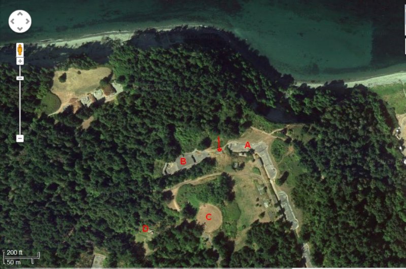

This screenshot from a Google Satellite image taken in August 2011 shows the location of the GPMTCP, the top of the visor is clearly visible, marked by the arrow. A=Battery Ash, B=Battery Benson, C=2,000,000 undergroung water cistern, D=Harbor Entrance Control Post, which was the location of the GPMTCP and Fort Command from 1908 until 1943.
Photo album created with Web Album Generator